How to Navigate AFF's New Data Visualization Tool
Nearly 40% of US forests are family owned, but landowners often struggle to keep up with the costs to ensure healthy and resilient forests, which can lead to wildfires, disease, and invasive species.
That’s why the American Forest Foundation launched a new interactive map showing the numerous benefits of conserving privately-owned forests. By compiling several previously disparate data sources into one centralized map, the tool shows how the Family Forest Carbon Program, alongside communities, companies, and policymakers, can protect the health of family forests and unlock their environmental, social, and economic potential.
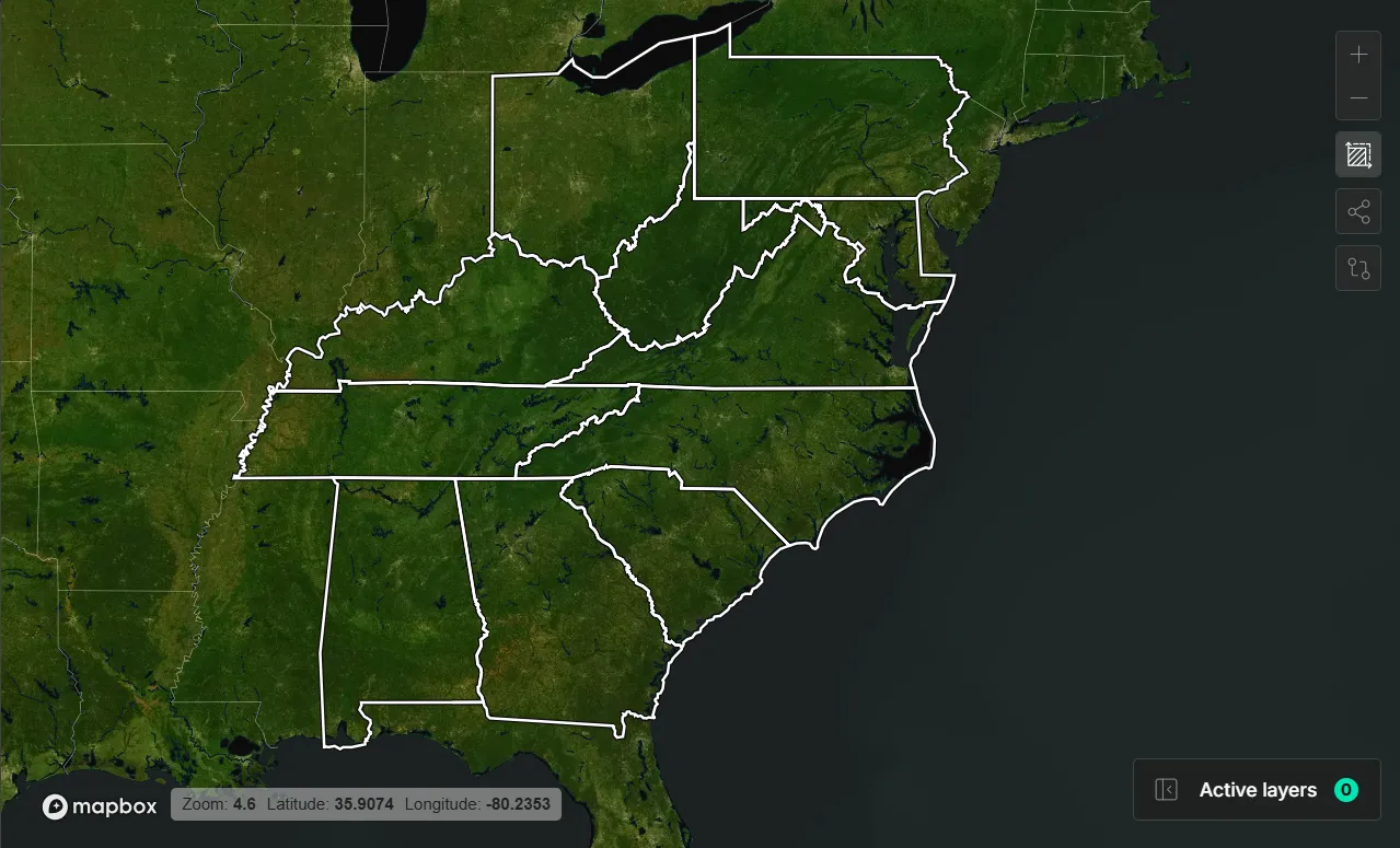
Data Map
The Family Forest Carbon Program protects America’s forests by combining high-integrity science with on-the-ground support for landowners. The map compiles several previously disparate data sources into one centralized map, showing users a more comprehensive picture of the multifaceted benefits of privately-owned forests, as well as the threats they face. On each of the 21 layers available, users can find details about the data sources the map uses. Here are some of the layers you can choose from, and how they tell the story of FFCP-enrolled properties.
Participating Project Areas
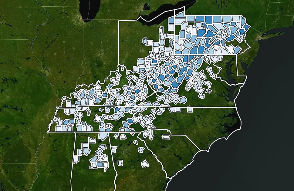
FFCP currently spans 20 states, including more than 180,000 acres owned by more than 1,000 families, but what does that actually look like geographically? This tool only covers FFCP project areas within the Central Appalachians, and to maintain landowner privacy, there are no specific property distinctions. You can see where project areas are located and how many acres are enrolled in each of those areas. This paints a picture of our widespread reach across the US.
Land Cover – Dynamic World
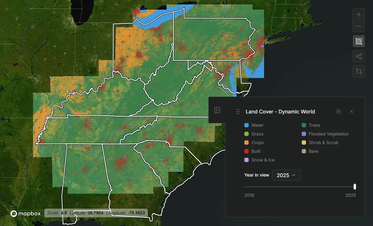
This layer allows users to see how land is currently being used across the region, including if it is trees, grass, crops, snow & ice, crops, shrub & scrub, bare, flooded vegetation, or built. Using this layer, you can see where the built, urban areas, indicated in red, spread into the grass and forests around them, indicated in green. This spread will only continue as our society progresses, which is why FFCP works with landowners to save their properties from development and keep forests as forests.
Importance to Surface Drinking Water Index
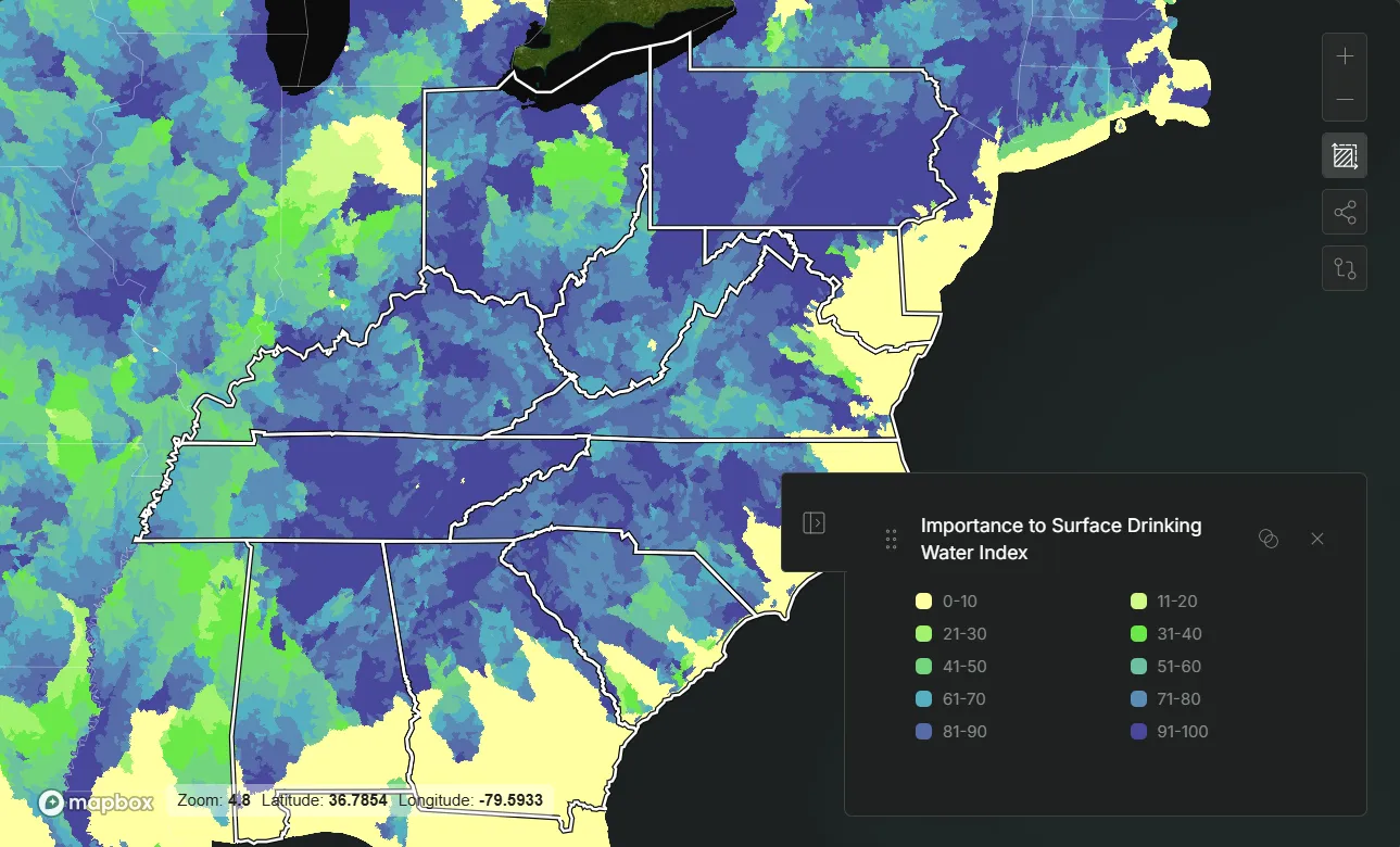
The Importance to Surface Drinking Water Index layer shows subwatersheds across the eastern United States and ranks their importance to surface drinking water supplies for people downstream. Most of our Central Appalachian project areas rank 60 to 100 on the scale of importance. These participating family forest owners are on the front lines when it comes to the water crisis, protecting their streams and water sources for the benefit of not just their community, but those below them.
Connectivity and Climate Flow
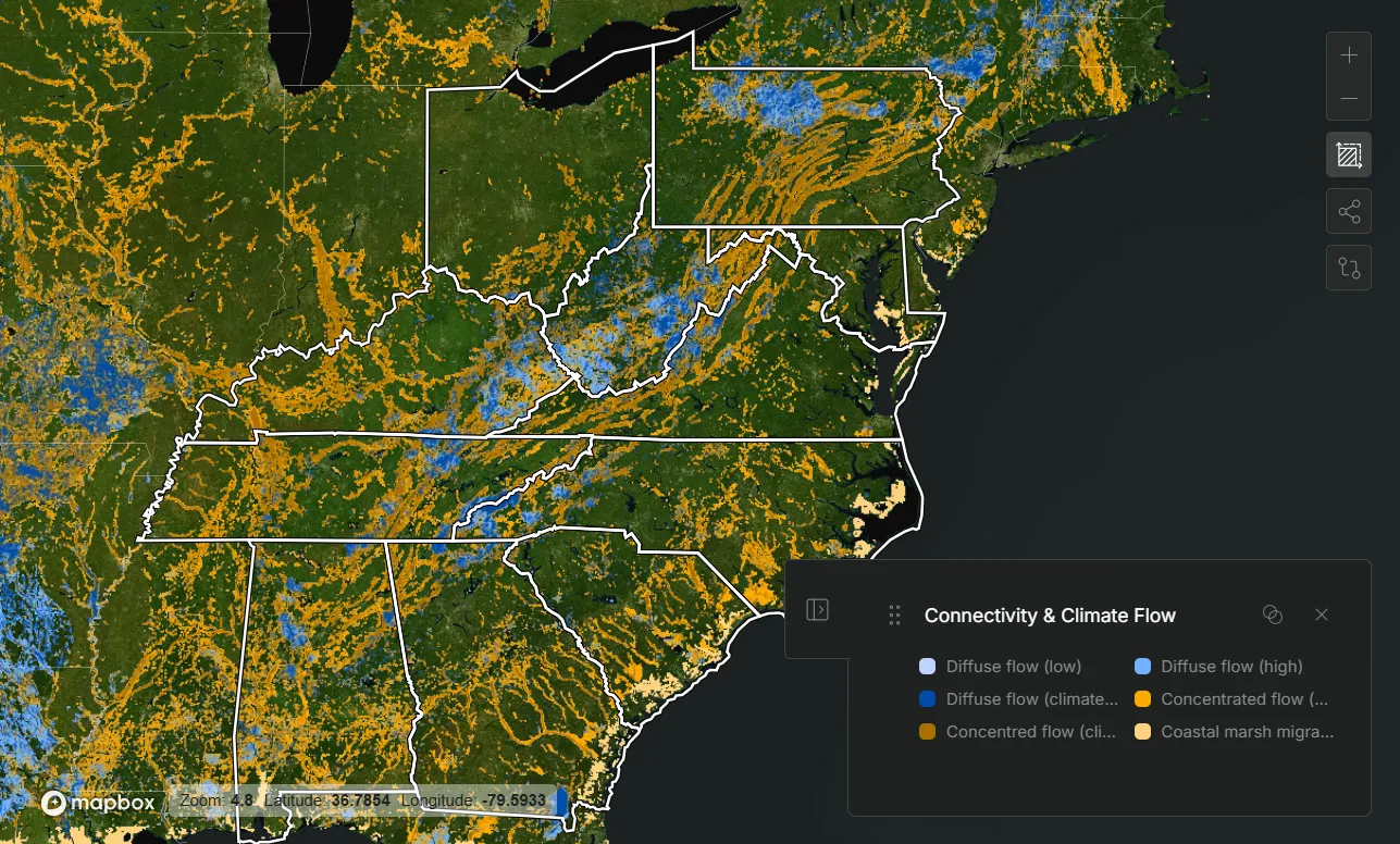
This layer shows how climate-related ecological flow moves across a landscape and where movement is diffused, concentrated, constrained, or blocked. In a reforestation context, it helps show where forests already support landscape connectivity and where restoration could strengthen it. The areas of concentrated flow, indicated in orange, are where large amounts of flow are funneled through a narrow corridor. These pinch points are strong candidates for protection and targeted reforestation because they help maintain connectivity across the larger landscape, and we can see that they run through many of our project areas.
Timber Products Output
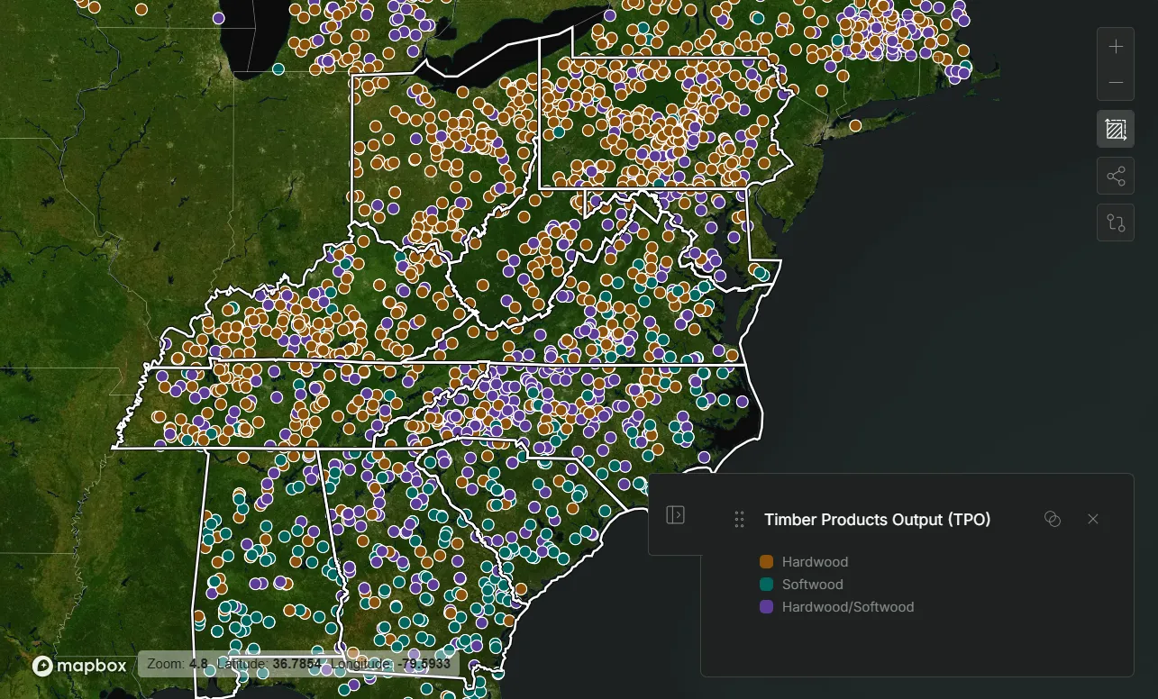
This layer shows public timber mill locations for 20 eastern and southeastern U.S. states, with one point per distinct public mill in the latest survey year available for each state. AFF supports sustainable harvesting, and helps landowners manage their land for healthier, more resilient forests. We are helping landowners keep their trees growing longer, pulling more carbon out of the atmosphere and storing it for eventual use in high-quality, long-lived wood products.
Species Layers
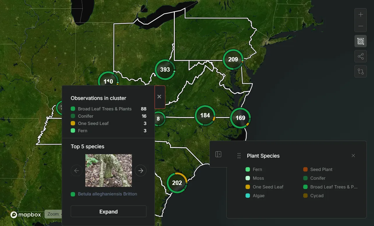
A key motivator of sustainable forest management is creating healthier wildlife habitats. There are different layers showing Vertebrate Species, Invertebrate Species, and Plant Species. Each layer highlights the top 5 species in each location and lists the number of other species types present. This gives a glimpse into the biodiversity present in these environments, showcasing the creatures that inspire so many forest owners.
Dashboard
The Dashboard is where you can find all the information you need about FFCP. From our stakeholders, partners, accreditations, methodology, contracts, and co-benefits. It is separated into different sections including About the Project, Governance and Status, Key Performance Indicators, Land Cover, Cobenefits, Documentation, and Multimedia. Now you can locate critical information in one central location.
Key Performance Indicators
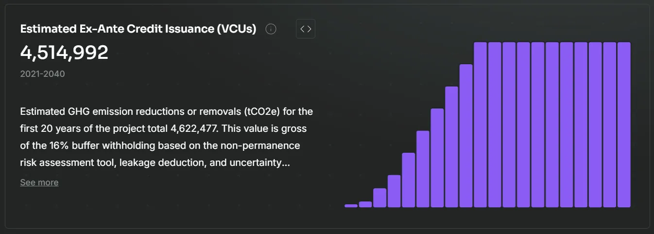
The Key Performance Indicator section explains how FFCP handles quantification, additionality, permanence, and cobenefits. For example, under the Permanence tab, you can see different reversal risks within our project areas, including wildfire, drought, cyclones, and flooding - and the approaches we take to mitigate these risks, including buffer pools and our Permanence Fund. The Quantification section shares updates on our estimated reductions and issuance progress.
Documentation
The documentation section houses documents on an overview of our Central Appalachian projects and our landowner contract structure. These documents detail what they can expect to be paid, any restrictions on the land, the benefits they receive, and more.
These documents are also important for potential buyers or funders who would like to do their due diligence. They can access information on third-party ratings, methodology, and overall program design.
Multimedia
You can hear directly from our landowners in the multimedia section, where you can access videos diving into their experiences enrolling and participating in FFCP. Our Living Legacy Series feature, produced for AFF by BBC StoryWorks Productions on landowner Kathy McClure, further explains our methodology and measurement practices. There are multiple landowner story articles as well, including how the Trezises are creating a family business on their property and what the Kaczmareks are doing to tackle invasive species.
To learn more about how to use the dashboard and data map to see how AFF is working with America’s family forest owners towards a better environment, we are hosting a demo on May 19th from 12 to 1 PM ET. Register now to reserve your spot! In the meantime, the tool is ready and free to access at https://app.transparenc.earth/AFF.
Related Articles
April 20, 2026
New Tool Visualizes the Conservation Benefits of American Family Forests
The American Forest Foundation (AFF) launched a new data visualization map that highlights the many conservation benefits of America’s family-owned forests.

November 12, 2024
New White Paper Sets Bar for Quality in Forest Carbon Projects
This week, the American Forest Foundation, a nonprofit organization that empowers family forest owners to create meaningful conservation impact, released its latest white paper, “Catalyzing Forest Carbon Project Quality: Addressing Issues of Integrity in Improved Forest Management Carbon Projects." The paper discusses the common challenges that IFM projects face in the voluntary carbon market and details four key elements the Family Forest Carbon Program (FFCP) focuses on to ensure high quality: additionality, permanence, leakage, and social integrity.

February 24, 2026
A One Millionth Tree for a One-in-a-Million Landowner
In February 2026, Portia's land was even the site of a project milestone: the celebratory planting of Fields & Forests millionth tree! “I wouldn’t have ever dreamed this as being something that could possibly even happen,” She shared her excitement for being a part of this incredible milestone.